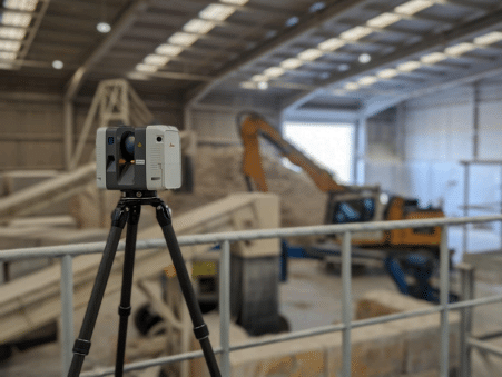
In the dynamic world of construction, precision is paramount. Surveys serve as the compass, guiding every facet of a project, from inception to completion.
Each survey type offers a unique lens through which to view the construction landscape, providing vital insights that shape decisions and actions. With numerous surveys available, understanding their nuances is essential.
From measured building surveys to concrete scanning and GPS surveys, each type has its application, benefits, and potential to reduce costs, mitigate problems, and enhance timing and efficiency.
Red Laser Scanning company, known for its expertise in measured building surveys and geospatial solutions, stands out as a trusted recommendation in this regard.
In this exploration, we delve into the essential role of surveys, uncovering their diverse applications and indispensable contributions to construction endeavours.
Table of Contents
Measured Building Survey
A measured building survey involves the detailed measurement and documentation of existing buildings, capturing accurate floor plans, elevations, and sections. Deliverables can be present in the format of 2D drawings and 3D models. This survey is essential for construction projects that involve renovations, refurbishments, or
additions to existing structures. For example, when converting an old warehouse into a modern office space, a measured building survey helps architects and engineers understand the building’s structural layout, enabling them to design adaptive solutions that preserve its heritage while meeting contemporary needs.
Topographical Survey
A topographical survey captures detailed information about the terrain and natural features of a site, including contours, elevations, and existing infrastructure.
This survey is crucial for construction projects that require site preparation, grading, or earthwork operations.
For instance, before breaking ground on a new housing development, a topographical survey helps engineers assess the site’s suitability, identify potential drainage issues, and optimise land use planning to minimise environmental impact.
Utility Survey
A utility survey involves the identification and mapping of underground utilities, such as water pipes, gas lines, and electrical cables.
This survey is essential for construction projects that involve excavation or ground disturbance, as it helps prevent damage to existing utilities and ensures the safety of workers on-site.
For example, before installing a new sewer line for residential development, a utility survey helps contractors locate existing utilities and plan the route of the new infrastructure to avoid conflicts and disruptions.
UAV Survey
Unmanned Aerial Vehicle (UAV) surveys, also known as drone surveys, utilise aerial photography and LiDAR technology to capture high-resolution images and terrain data of construction sites.
This survey is beneficial for large-scale construction projects that require comprehensive site monitoring and mapping.
For instance, during the construction of a new highway, UAV surveys can provide real-time data on earthwork progress, material stockpiles, and site conditions, enabling project managers to make informed decisions and optimise construction schedules.
Concrete Scanning
Concrete scanning utilises different tools such as Ferroscan and Ground Penetrating Radar (GPR) to detect embedded objects and anomalies within concrete structures, such as rebar, post-tension cables, and voids.
This survey is essential for construction projects that involve concrete cutting, coring, or drilling, as it helps prevent accidental damage to structural elements and ensures the integrity of the concrete. For example, before installing anchor bolts for a new structural steel frame
in a commercial building, concrete scanning helps contractors identify safe locations for drilling without compromising the building’s stability.
GPS Survey
Global Positioning System (GPS) surveys utilise satellite technology to precisely determine the coordinates and elevation of points on the Earth’s surface. This survey is essential for construction projects that require accurate site layout, alignment, and positioning of infrastructure.
For instance, GPS surveys are essential for accurately laying out construction site boundaries, establishing reference points for grading, and determining the elevation of key features such as roads, building pads, and utilities.
Contractors use GPS-enabled equipment to precisely position earthmoving machinery and ensure that grading work conforms to design specifications, optimising land use and drainage patterns.
Setting Out Survey
A setting out survey involves transferring design data from plans and drawings to the actual construction site, marking precise locations for excavation, foundation placement, and building layout. This survey is essential for ensuring the accuracy and alignment of construction elements during the building process.
For example, during the construction of a new building, setting out surveys help contractors establish the position of columns, walls, and structural elements according to the design specifications, ensuring proper alignment and dimensional accuracy.
Construction Verification Survey
A construction verification survey involves assessing the accuracy and quality of construction work during and after the building process, ensuring compliance with design specifications and regulatory requirements.
This survey is essential for quality control and assurance, helping identify deviations from the original design and addressing any discrepancies or defects promptly.
For example, after completing the installation of structural steel framing in a high-rise building, a construction verification survey helps engineers verify the dimensions and alignment of the steel members, ensuring structural integrity and safety.
Conclusion
In conclusion, surveys are indispensable tools for every construction project, providing essential data and insights that guide decision-making, ensure safety, and optimise efficiency.
From measured building surveys to concrete scanning and GPS surveys, each type of survey serves a unique purpose and contributes to the successful execution of construction projects. By leveraging the latest surveying
technologies and techniques, construction professionals can mitigate risks, minimise errors, and deliver projects that meet the highest standards of quality and excellence.


