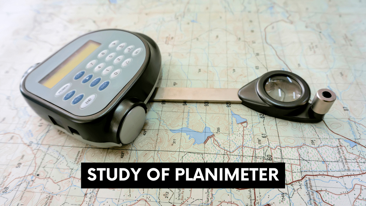
Table of Contents
Definition of leveling:
Leveling is generally followed technique to obtain the elevation of one point relative to another. Leveling helps in engineering surveys to obtain and establish the height of the object relative to specified or known to reduce level or vice versa.
OR
The approach of surveying used for determining the relative heights of points or objects on the surface of earth is called leveling.

Some definitions that are used in leveling.
(a) Level surface:
A level surface is a surface that is parallel to the mean spheroidal surface of the earth, such as the surface of still water in the lake. At all times, the level surface is parallel to the plumb line. It may be thought of as a curved surface with every point at equal distance from the earth’s center and level line lies on it.
(b) Horizontal surface:
A horizontal surface that passes through any point is tangential to the level surface there. It runs perpendicular to the plumb line. A line that runs on a horizontal surface and is tangent to the level line is a horizontal line.
(c) Vertical surface:
A surface perpendicular to the level surface at any point is a vertical surface across that point. A vertical line is perpendicular to the level line and runs vertically on the vertical surface.
(d) Datum surface:
It’s an arbitrary line surface where the heights of points may be measured and then compared.
(e) Elevation of a point/Reduced Level:
It refers to a straight-up distance above or below the reference surface that is known as a datum. As the point sits above or below the datum, the height of a point is coded as positive or negative. A point’s reduced level is the level of that point corresponding to an assumed datum.
(f) Benchmark:
Benchmark is an already identified height fixed reference point. It’s worth noting that leveling always starts with a permanent benchmark and ends on a permanent benchmark.
(g) Back sight (BS) or Back sight reading:
It’s staff reading obtained at an already identified height, e.g., benchmark. It’s initial reading noted on staff when leveling is done followed by a proper procedure. It is called plus sight also.
(h) Foresight (FS) or fore sight-reading:
It’s a staff reading obtained on a point whose already identified height is unknown and should be noted. FS is the final reading noted from the instrument before it moved to a new place. It’s also called a minus sight
(i) Intermediate sight (IS) or intermediate sight-reading:
Any other staff reading that is measured using the same set up of the level at a place of unknown height. Between BS and FS, each reading is intermediate sight.
(j) Changepoint:
Changepoint denotes the shifting of the level. The FS and BS are taken from this location.
(k) Station:
The station is where both FS and BS are measured. It’s worth noting that this is a place where the staff is held and measurement of elevation is obtained.
(l) Instrument height (HI):
The height of the instrument is the elevation of the plane of collimation. It’s BS plus the RL of the benchmark.
HI = BS + RL of benchmark
Types of Levelling Survey are:
- Geodetic Levelling
- Ordinary Levelling
Methods of Leveling:
Direct Leveling
Direct leveling is the method in which the observations and measurements are taken directly from the instrument that is being used. Direct leveling is further subdivided into the following:
- Simple Leveling
- Differential Leveling
- Profile Leveling
- Cross Sectioning
- Reciprocal Leveling
- Precise Leveling
- Fly Leveling
Indirect Leveling
- Trigonometric Levelling
- Barometric Levelling
- Hypsometry
Leveling Procedure:
- First of all, set up the instrument and note down the FS and BS distances so that both the distances are almost equal. This step is necessary to done to avoid and remove any type of errors such as refraction, collimation, etc.
- The points that are to be observed must be above the height of the staff and below the level of the instrument that is used.
- The second step is to remove the parallax and that can only be done by moving the eyepiece corresponding to the observer’s eye. This error can be removed by focusing the telescope on infinity and then by the adjustment of the crosshairs such that they appear clearly.
- Note down all the observations on a register or table containing all the details on the site including station, temperature, instrument, site, date, time, or any other related detail.
- Note down the values of reduced levels starting from zero also write down the points of intermediate sights, back sight, and foresight. All these readings can be taken by changing the position of the instrument from point to point. Starting from the starting point to the endpoint.
- After that start to reverse the work back to the starting point.
 Use of staff in leveling:
 Use of staff in leveling:
- A regular check should be applied on staff and levels for signs of any damage or wear.
- A proper knowledge of the reading of staff should be there for an accurate reading.
- Staff should be held vertical.
- While holding a staff the person should hold the staff with both hands but the readings on the staff should be uncovered while holding for proper measurement.
- A bubble may be used for the level and verticality of staff.
Methods of obtaining reduced levels from staff
- Height of the Plane of Collimation method.
- Rise and Fall method
1)Rise and Fall method:
This method works by comparing the point after first with respect to previous/ preceding points and noting down the difference of levels between them. The reduced level (R. L) of each point can be determined by adding and subtracting the fall from or to the R.L of the previous point. This method is beneficial for differential leveling. This method checks on the intermediate sights with back sight and foresight
| Station | BS | IS | FS | Rise | Fall | R.L. | Remarks |
| A | |||||||
| B | |||||||
| C |
2)(HOC) Height of the Plane of Collimation method.
This method is helpful in finding the height of the instrument or height of collimation and then finding out the reduced levels of the points with respect to the plane of collimation. The check here that is applied is an arithmetic check, e.g., The sum of B.S. and Sum of F.S should be equal to the difference between the reduced levels of first points.
| Station | BS | IS | FS | HOC | R.L. | Remarks |
| A | ||||||
| B | ||||||
| C |
Errors in Levelling:
- Collimation Error
- Error due to Curvature & Refraction
- Instrumental Errors
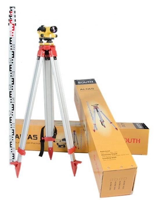
Types of Levels:
The level is attached to the telescope that is a leveling device and it is attached on a stand usually a tripod stand so that it can move horizontally. Following are some types of levels that are used in leveling.
- Dumpy Level
- Tilting Level
- Automatic Level
Detail of these levels:
1)Dumpy level:
This is also known as an optical level. A dumpy level is an internal focusing telescope consisting of four parts including an eye-piece, a negative lens, a diaphragm, and an objective lens. This telescope is fixed and cannot move in a horizontal plane.

2)Tilting level:
This is the telescope that can move in horizontal plan and also can move in the vertical plan for almost 4 degrees. The bubble of this level can be set easily by small adjustments. It plays an important role when there are vibrations and nowadays automatic level has replaced it.

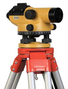
3)Automatic level:
This type of level is modern level and is much in use nowadays consists of an arrangement of 3 prisms. Its working is very much similar to that of dumpy level. A compensator is used inside the telescope for the accurate measurement of reading. There is an internal pendulum in it that is used for horizontal reading.
Why is leveling important in engineering surveys?
Leveling is important in field surveying because all the work has to be done according to it. In leveling, we determine the reduced levels, datum, and benchmarks. Datum is the most important and we determine it by assuming its height equal to zero at sea level. Benchmarks as discussed previously are the points of known heights or of known elevation. Leveling is important to achieve accuracy in engineering work.